Valley of Fire State Park in southern Nevada is known for its Aztec sandstone formations, which glow vibrant shades of red. But did you know that there’s an unmarked and unsigned pink slot canyon that lays hidden within its fiery walls?
If exploring an incredible cotton candy pink rock formation that’s off-the-beaten path (literally!) sounds up your alley, buckle up- here’s everything you need to know about the Pink Canyon, Valley of Fire’s amazing hidden gem.
This post may contain affiliate links. If you make a purchase through them, we may receive a small commission, for which we are extremely grateful, at no extra cost to you.

")
How to Get to the Pink Canyon Trailhead
The Pink Canyon is located in Valley of Fire State Park, just an hour northeast of Las Vegas in the tiny town of Overton. There isn’t public transit to the park, so you’ll need a vehicle (either your own or a rental car) or there are some tours, like this one, that will take you right to the park.

Upon entering the park, you’ll need to pay a $10 entrance fee if you have a Nevada license plate or $15 if you’ve got a non-Nevada plate. The park is only open from sunrise to sunset so if you’re trying to catch sunset in the park (the most stunning time of day here, in my opinion- the rocks literally look like they’re on fire!), you’ll need to hightail it outta here as soon as possible. The rangers have been known to issue fines to folks in the park after hours.
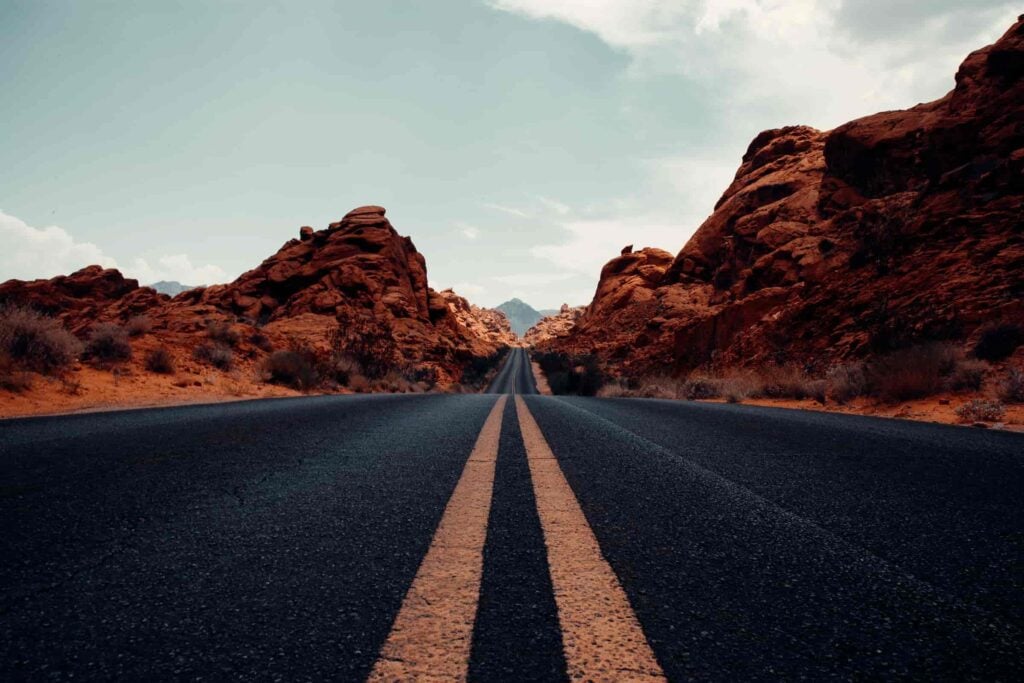
There’s one road that cuts through the Valley of Fire and dead ends towards the back of the park- called Mouse’s Tank Road. The Pink Canyon (also called the “Pastel Canyon”) is all the way towards the back of the park- you can park in this parking lot and make your way to the Pink Canyon from there.
There are about a gazillion signs indicating that parking is prohibited along Mouse’s Tank Road, so let’s all be respectful of beautiful public lands and only park where we’re allowed (another incentive to not park along the road? Rangers here love to give out tickets!).
Word of warning- visiting the Valley of Fire and the Fire Wave are some of the best things to do in Las Vegas during the daytime– and they definitely receive the crowds to prove it! Accordingly, if you want to be sure to snag a spot, I’d recommend getting here pretty early, especially if you’re visiting during the park’s busy season from February through May.

The Pink Canyon Trail
Since the Pink Canyon is an unmarked formation in the park, there’s no “official” way to get there. However, there’s a few different paths you can take to explore the canyon.
- The opening of the canyon is here, right along Mouse’s Tank Road, so you can simply walk south from the parking lot alongside the sandy shoulder of either side of the road for 0.7 miles (just don’t walk on the road itself and keep a look out for cars- they tend to drive too fast here!).
As you approach the opening of the mouth of the canyon (which, if you’re coming from the Fire Wave parking lot, will be on your left hand side), you’ll notice a trail of footsteps in the dirt that lead into a narrow opening in the cliff walls. Slip into that opening and boom- you’re in the Pink Canyon!

- Alternatively, you can hike the Fire Wave trail, which starts right across from the parking lot at a well-marked trailhead (if you’re interested, you can check out our post all about the Fire Wave trail) and continue hiking south past the Fire Wave, down the slopes of the rock formation. Be careful climbing down- the rock is super steep here in some parts and can be quite slick!
Once you’ve reached the ground, you’ll find a rocky wash that you can follow southwest about 0.3 miles until you reach the back of the Pink Canyon. There does not appear to be an AllTrails for this route, but you can use the maps for the Fire Wave Trail and the trail from the Fire Wave to the Pink Canyon to find your way. In total, this hike is 2.3 miles roundtrip.

- Finally, you can reach the Pink Canyon as part of the 2.3-mile Seven Wonders Loop, an unofficial hike past several cool geological structures. You’ll start this trail the exact same way as the last option- leaving from the Fire Wave trailhead, hiking south past the Fire Wave, and entering the Pink Canyon from its northern opening.
Instead of retracing your footsteps back to the Fire Wave, though, you’ll exit the Pink Canyon from its southern end and cross Mouse Tank’s Road heading west. You’ll continue the loop, passing a bunch of points of interest, like the Fire Cave and Thunderstorm Rock, until you finally return to the Fire Wave parking lot.
Truthfully, I didn’t know about this option until after our visit to Valley of Fire and, with its many cool sites along the way, I would have definitely chosen this path had I known!

The Pink Canyon is a slot canyon, with scalloped sandstone walls that reach overhead. Due to the oxidation of different minerals in the sandstone, like manganese, the walls are a swirling mixture of different colors, from pink to orange and even hints of greens.
The canyon itself is pretty small- less than 0.2 miles long- but it’s such an unusual experience (like walking through walls made out of ice cream!), it’s 100% worth exploring!


Tips for the Pink Canyon
- If you’re looking to experience the canyon at its most vibrant, I’d recommend coming here in the early morning or right before sunset. The pastel color of the rocks can get washed out in the direct sunlight- plus it’ll be a whole lot cooler if you avoid going on your adventure in the middle of the day!

- Given the Pink Canyon is unsigned and none of these trails are “official”, it can be a bit confusing to know where you’re supposed to go. I’d highly recommend downloading the map for the route you’d like to take ahead of time on AllTrails– cell service can be spotty to non-existent here.
- It can get hot in the Valley of Fire- like, well over 100 degrees hot. So please bring along plenty of water (the first time I visited Valley of Fire, I almost passed out from the heat). My husband, Justin, and I have these giant Nalgene bottles and take them everywhere- they’re better for the planet than single-use bottles and way easier on the wallet.
It’s also worth noting that the park often closes its hiking trails during periods of excessive heat, such as July through September, to protect the safety of hikers, the park’s staff, and local rescue operations. So, before you head to the park during warmer months, be sure to check the park’s official website to ensure the trails are actually open. Not only is it dangerous to be hiking these trails in extreme heat (multiple hikers have died here), but Valley of Fire rangers are quite keen to give out tickets for noncompliance with the rules!

- I hope this goes without saying, but please follow the Leave No Trace principles while you’re exploring the Pink Canyon and Valley of Fire, like leave what you find (please, please, please don’t carve your name or otherwise deface the beautiful rocks here) and dispose of waste properly (pack it in, pack it out). Always leave places better than you found them!
Where to Stay Near Valley of Fire
If you’re looking for a peaceful respite from the neon lights and chaos of Sin City, a few days exploring Valley of Fire is an excellent addition to your Las Vegas itinerary.
If you’re looking for a place to stay by the park, for my RVer friends (or you just like camping!), there’s two established campgrounds in the park, Atlatl Rock Campground and Arch Rock Campground, which operate on a first-come, first-serve basis. Alternatively, Justin and I camped (for free!) at the nearby Valley of Fire West Dispersed Camping Bureau of Land Management land and had an excellent time soaking up the mountain views and endless desert vistas there.

If you’d prefer to stay in more formal accommodations, check out the North Shore Inn at Lake Mead, a fairly simple but clean and comfortable hotel just a short 15 minute drive from the Valley of Fire. Here, you’ll find free breakfast, comfortable beds, and an outdoor pool to help you cool down from that desert sun.
I loved my time exploring the Pink Canyon, Valley of Fire’s most beautiful hidden gem. Do you have any questions about how to get to the canyon? Ask away in the comments below!
Thank you for reading our post! Check out our latest stories here and follow us on Instagram (@JustinAndJess_), YouTube, TikTok, or on Facebook to see what we’re up to next!

The trails are closed until it cools off. 2 hikers died of heat exhaustion last week. Please do not recommend people go there until summer is over. They will be fined
Hi Marie,
Thanks for flagging! I have updated the article accordingly to note that the trails may be closed in periods of excessive heat and to abide by such restrictions for the safety of the hikers, local rescue operations, and park staff.
Thanks for reading,
Jess