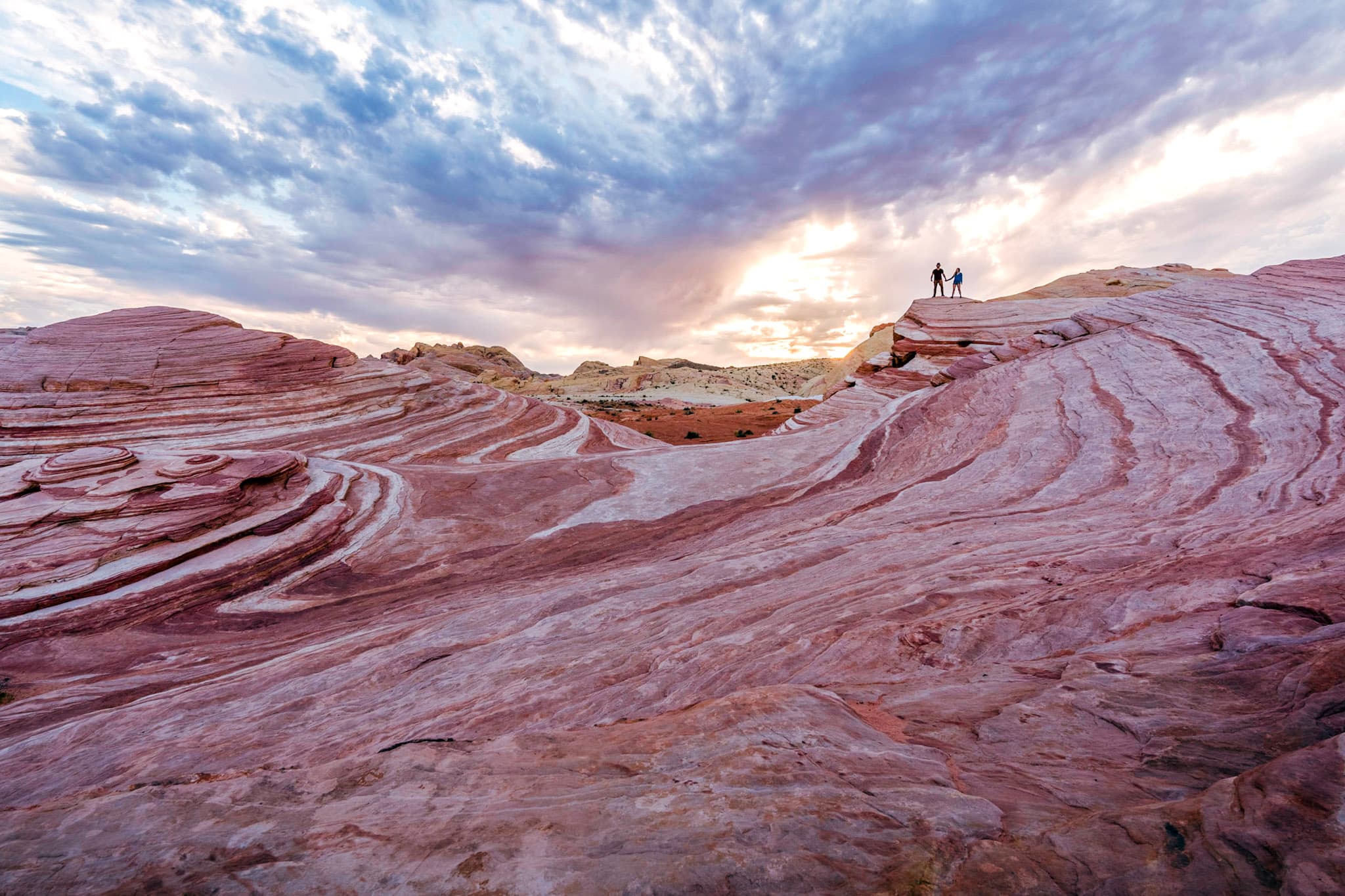
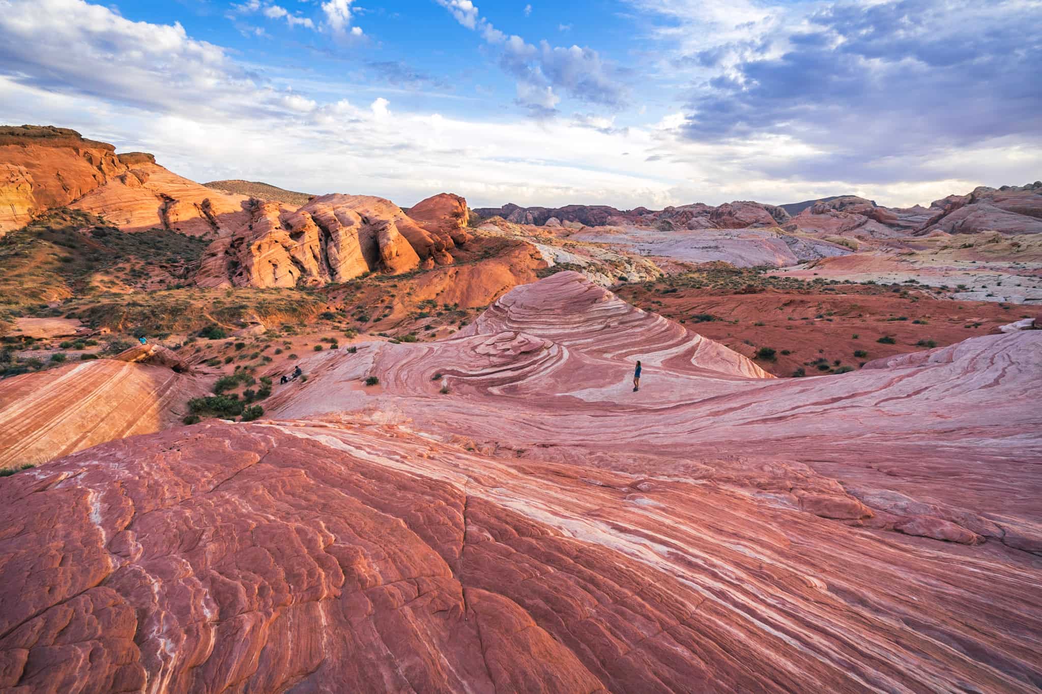
Valley of Fire State Park in southern Nevada is iconic for its stunning landscape of vibrantly red rock cliffs and canyons. While the entire park is absolutely worth exploring, if you’re going to only make one stop in the park, it should be to the Fire Wave trail, which leads you to an eye-popping rock formation of swirling pink, orange, and white stripes.
While some unenthused and likely misguided trekkers might disagree with our recommendation (more on that below), if you’re looking to explore some of Nevada’s seriously underrated natural beauty, throw on those hiking boots and let’s hit the road- here’s everything you need to know about the Fire Wave, Valley of Fire’s otherworldly outdoor playground.
This post may contain affiliate links. If you make a purchase through them, we may receive a small commission, for which we are extremely grateful, at no extra cost to you.

")
About the Fire Wave Trail
Length: 1.5 miles
Elevation gain: 236 ft
Difficulty: Easy (suitable for all kinds of hikers!)
How to Get to the Fire Wave Trail
As mentioned above, the Fire Wave is in Valley of Fire State Park is located in Overton, Nevada, just an hour northeast of Las Vegas. Given its proximity to the city, Valley of Fire makes the perfect little day trip, even if you only have one day in Las Vegas.
That being said, there isn’t public transit to the park, so you’ll either need a vehicle (either your own or a rental car) or there are some tours, like this one, that will take you right to the park.

To enter Valley of Fire, you’ll need to pay a $10 entrance fee for vehicles with a Nevada license plate or $15 if you’ve got a non-Nevada license plate. It’s also worth mentioning that the park is only open from sunrise to sunset, so if you’re hoping to catch sunset at the Fire Wave (it’s quite gorgeous!), you’ll need to seriously hightail it back to your car and out of the park- if you’re in the park outside of opening hours, don’t be surprised if you’re fined by a ranger!
There’s one main road that runs through and dead-ends at the back of the park, Mouse’s Tank Road- the trailhead for the Fire Wave is located here, all the way towards the end of the road. There’s a parking lot right by the trailhead, but it’s fairly small, holding about 20 or so cars.

Visiting the Valley of Fire- and the Fire Wave- is one of the best things to do in Las Vegas during the daytime– and it definitely has the crowds to prove it! So given the small parking lot here and the fact that there’s about a bazillion signs telling you not to park alongside the road, I’d encourage you to get here early if you’re visiting on a weekend, especially during the park’s busy season, from around February through May.
Another bonus of getting here early? You’ll avoid the midday heat! It can get BRUTALLY hot in the park and there’s no shade along the trail. I’ve hiked the Fire Wave on two separate visits and during my trip in September, I almost passed out from the intense heat (the sandstone in the park just kind of radiates heat!).
What causes the Fire Wave?
Hikers flock to the Fire Wave because it frankly looks straight-up otherworldly. But, as you may know, it’s not the only striped sandstone formation in the American southwest- just four hours east, you’ll find The Wave, a much more famous sandstone structure with swirling stripes of vibrant colors, found along the slopes of Coyote Buttes, Arizona.

Given, however, that the Wave requires a permit that’s notoriously tough to snag (less than 5% of applicants get it- as a three time Wave permit-loser, I can confirm it’s an elusive beast), the Fire Wave is an excellent way to experience this kind of mindblowing rock formation, up close and personal, without snagging one of those pesky permits.
But what makes it look so dang cool?

Valley of Fire’s vibrant colors come from bright red Aztec sandstone that forms its canyon walls. The Fire Wave itself, though, looks completely different than the rest of the park, with its rolling hills of candy-colored striations.
The wave-like shape is simply the result of good old-fashioned erosion from wind and water over the course of the last 150 million years. And the unique colors come from the oxidation of iron and manganese contained in the rock (creating the red and pink stripes), with the white striations resulting from the sandstone being bleached white from millenia of water exposure. Isn’t science rad?

What to Expect Along the Fire Wave Trail
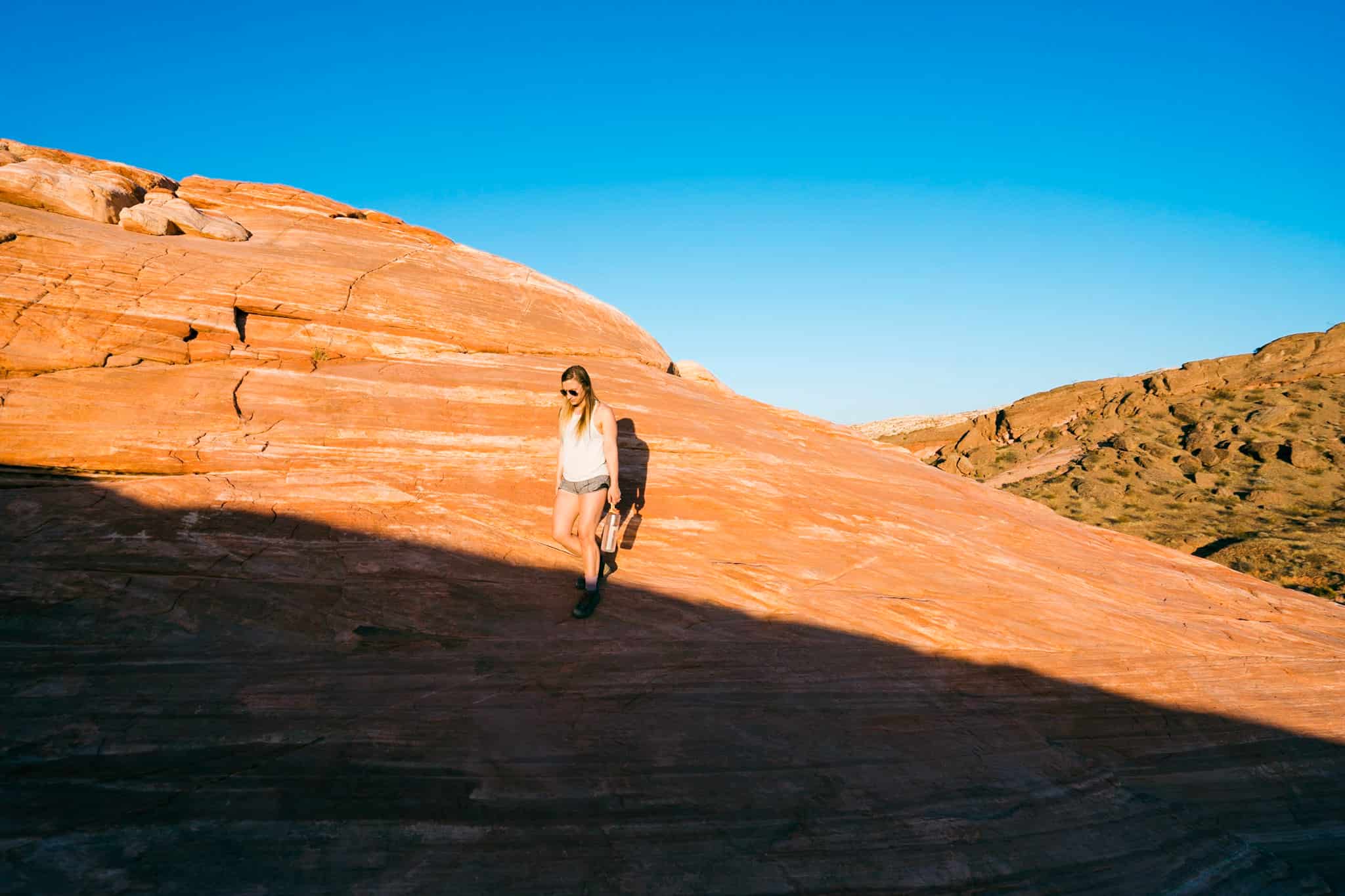
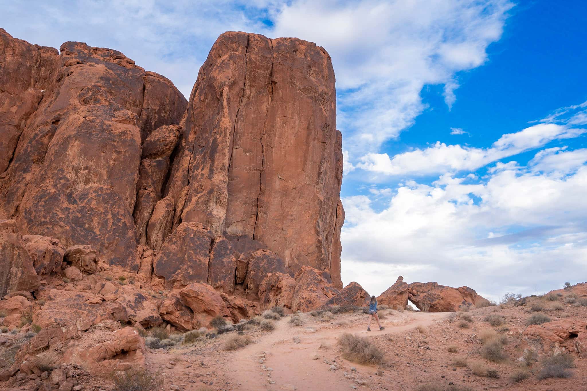
Across from the parking lot, the trailhead is clearly marked, with the trail initially sloping gently downhill. You’ll follow along a soft sand path, with an enormous ridge of red sandstone on your left hand side.
The sand underneath your feet will get more compact as the trail snakes around this enormous wall of rock, towering hundreds of feet overhead. You’ll eventually pass a wash strewn with small boulders and the trail will begin to climb upwards over slick rock.
From here, all you need to do is keep an eye out for the black trail markers sticking straight out of the rock, leading towards the south. They’re spaced out pretty far and can be kind of hard to see, but other hikers have added cairns (those little piles of rocks) that help lead the way. Just keep a lookout towards your right hand side (or towards the south) and you’ll eventually spot the markers!
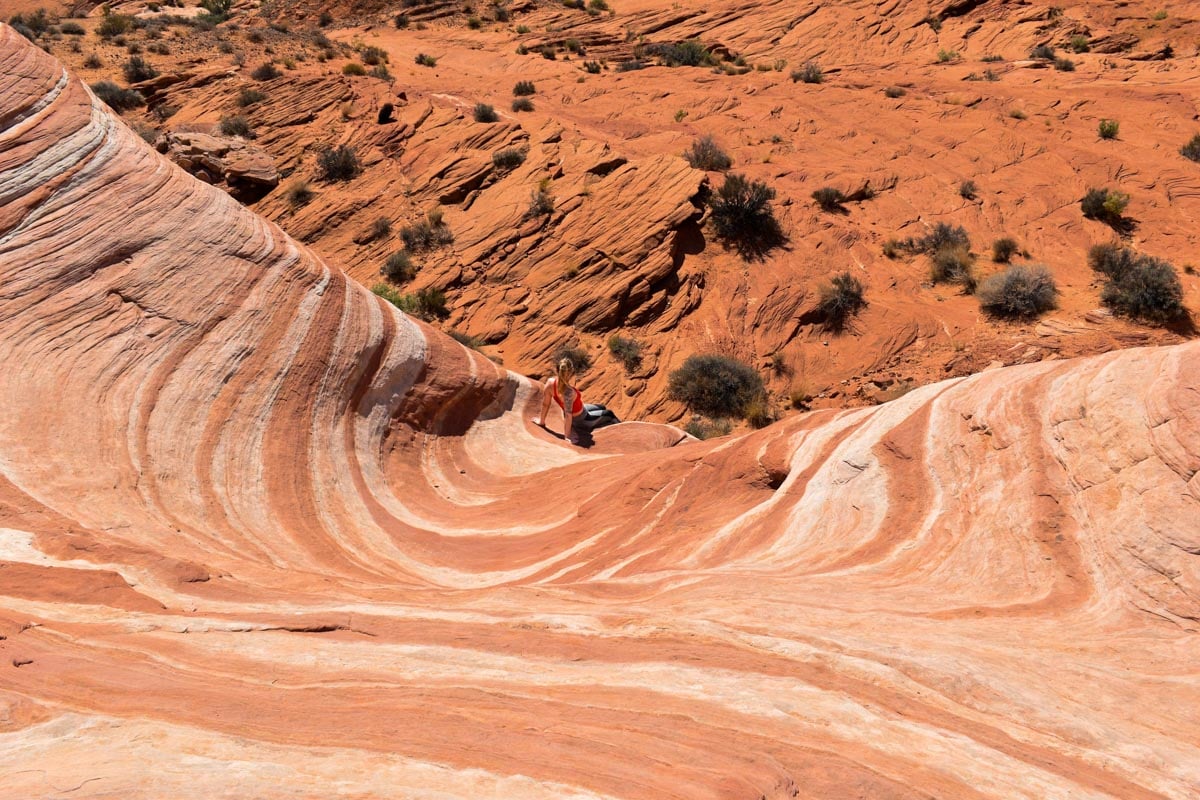
As you get closer, you may even notice light striations and the rock getting more and more vibrant underneath your feet. After about half a mile, the stripes along the rock will become much more pronounced and the trail will start leading you uphill. As you round the crest of the hill, you’ll see the bowl of the Fire Wave to the south. Frolick down the hill and go explore Mother Nature’s very own version of Candyland!

Pssst… looking to explore yet another cool rock formation? Consider hiking past the Fire Wave 0.3 miles (one-way) to see the hidden Pink Canyon, a slot canyon with walls of swirling colors of pastel pink and orange.
Tips for the Fire Wave Trail
- Listen, the Fire Wave is beautiful- like something straight out of a Dr. Suess book- but the formation itself is admittedly pretty small, covering an area that’s probably less than half of a football field. In fact, both times that we visited, I overheard other hikers complaining about how disappointed they were with it (e.g.., one hiker asked “Is this it?!” in an aggressively disgusted tone).
In their defense- a quick Google search of this location will instantly fill your browser with dozens of impossibly colored, rainbow-like cliffs and boulders. Unfortunately, many people have become overzealous with social media filters and color sliders, altering images of the Fire Wave trail in a manner that makes its topography look like someone’s acid trip.
Considering this, we can appreciate how some individuals expectations have been misguided. So, during your visit, temper your expectations and remember to take in the sheer beauty of nature during your visit, as opposed to comparing everything to what you expect to see from social media.
- Did I mention it gets hot here? So bring water- lots of it. My husband, Justin, and I take these giant Nalgene bottles with us on all of our hikes. They’re way better for the planet than single-use plastic bottles and are easier on the wallets. Score!
It’s also worth mentioning that Valley of Fire frequently closes its hiking trails in period of extreme heat, such as July through September, to protect the safety of the hikers, park staff, and local rescue operations. If you’re visiting during the warmer months, be sure to check the official park website to see whether the trails are actually open before heading here.
Not only is it dangerous to hike these trails in extreme heat, but the Valley of Fire rangers are known for their proclivity for handing out tickets! - We all like exploring the Fire Wave, right? Let’s make sure that the Fire Wave and other amazing natural sites stay open to the public by always following the Leave No Trace principles, like dispose of waste properly (pack it in, pack it out) and leave what you find (resist the urge to graffiti, carve, or otherwise deface the beautiful rocks here).
Where to Stay Near Valley of Fire State Park
If you’re looking to relax after a few crazy nights, spending a night or two out by Valley of Fire may just be the perfect addition to your Las Vegas itinerary.
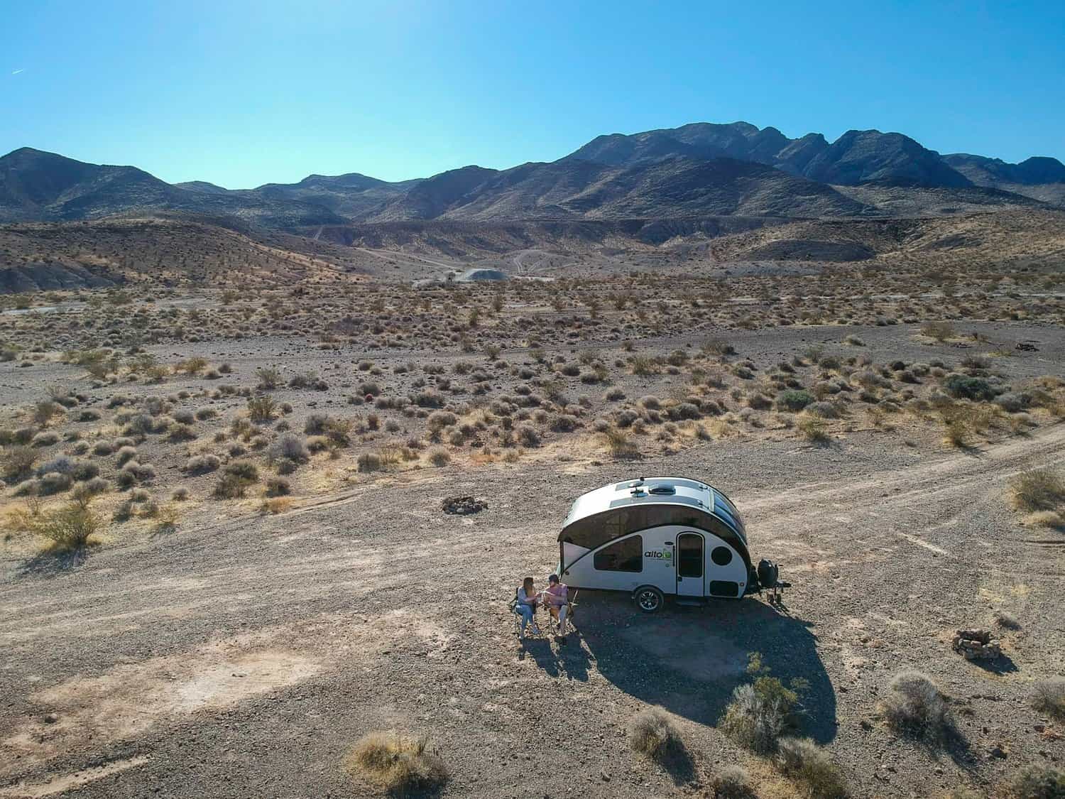
If you’re part of my RV fam (or just like camping!), there’s two established campgrounds in the park, Atlatl Rock Campground and Arch Rock Campground, which operate on a first-come, first-serve basis. Alternatively, Justin and I camped at the nearby Valley of Fire West Dispersed Camping Bureau of Land Management land (for freeeee!) and had a lovely time soaking up the beautiful desert views there.
If you’re, instead, looking for more formal accommodations, check out the North Shore Inn at Lake Mead, a modest but comfortable hotel just a short 15 minute drive from the entrance of the park. Here, you’ll find free breakfast, comfortable beds, and an outdoor pool to cool off in after all that hiking.
Now go forth and enjoy the Fire Wave, Valley of Fire’s most stunning rock formation! Do you have any questions about the trail? Sound off in the comments below!
Thank you for reading our post! Check out our latest stories here and follow us on Instagram (@JustinAndJess_), YouTube, TikTok, or on Facebook to see what we’re up to next!
